Property Record
21 Mcdonald Rd, Wurtsboro, NY 12790
NEARBY LISTINGS FOR SALE OR LEASE
-
-
View all Wurtsboro listings for sale on LoopNet.com
Property Detail
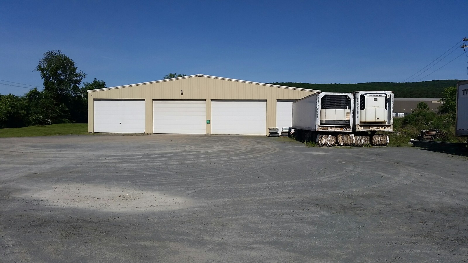
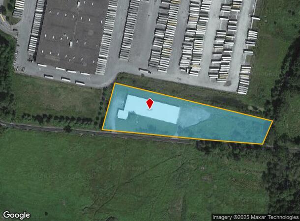
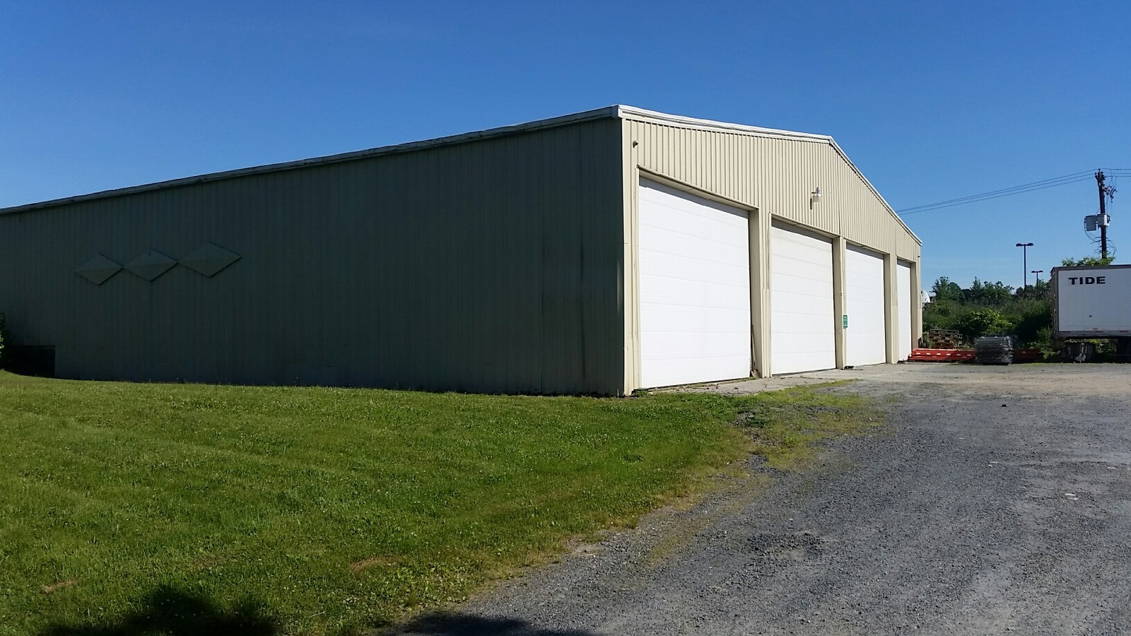
21 Mcdonald Rd
4089-026-0-0001-021-007
Kohls Distribution Center
Warehouse
LOT C MAP 7-427
X
Sullivan
36105C0654F
New York
2024
21.00
2023
5.22 AC
951201
Other Market Areas
34,400 SF
DEMOGRAPHICS near 21 Mcdonald Rd
1 Mile
3 Mile
5 Mile
2024 Total Population
160
6,723
12,768
2029 Population
160
6,828
12,929
Pop Growth 2024-2029
0.00%
+ 1.56%
+ 1.26%
Average Age
44
39
40
2024 Total Households
68
2,514
4,662
HH Growth 2024-2029
(1.47%)
+ 1.47%
+ 1.27%
Median Household Inc
$63,750
$63,710
$79,315
Avg Household Size
2.30
2.60
2.60
2024 Avg HH Vehicles
2.00
2.00
2.00
Median Home Value
$168,749
$195,051
$248,517
Median Year Built
1972
1970
1973
Nearby Places
- Restaurants
- Banks
- Shops
- Fitness
- Groceries
PUBLIC TRANSPORTATION
AIRPORT
New York Stewart International
DRIVE
WALK
Distance
New York Stewart International
42 min
28.0 mi
Freight Ports
Port Newark Container Terminal
DRIVE
WALK
Distance
Port Newark Container Terminal
109 min
85.0 mi
SALE & LEASE HISTORY
LISTING DATE
SALE/LEASE

Jul 18, 2018
For Sale
Nearby Properties
Address
Land Use
TOTAL SIZE
Lot Size
Zoning
Address
Land Use
TOTAL SIZE
Lot Size
Zoning
505,953 SF
89.17 AC
I
Address
Land Use
TOTAL SIZE
Lot Size
Zoning
4,219 SF
86.85 AC
RAG1
Address
Land Use
TOTAL SIZE
Lot Size
Zoning
4,200 SF
39.73 AC
RAG1
Address
Land Use
TOTAL SIZE
Lot Size
Zoning
3,606 SF
60.55 AC
BR
Address
Land Use
TOTAL SIZE
Lot Size
Zoning
28,000 SF
16.50 AC
R1
Address
Land Use
TOTAL SIZE
Lot Size
Zoning
1,680 SF
192.20 AC
RAG1
Address
Land Use
TOTAL SIZE
Lot Size
Zoning
924 SF
20.01 AC
RAG1
Address
Land Use
TOTAL SIZE
Lot Size
Zoning
15,056 SF
13.78 AC
C
Address
Land Use
TOTAL SIZE
Lot Size
Zoning
924 SF
24.52 AC
R4
Address
Land Use
TOTAL SIZE
Lot Size
Zoning
4,893 SF
0.53 AC
C1
Address
Land Use
TOTAL SIZE
Lot Size
Zoning
1,568 SF
47.33 AC
RAG1
Address
Land Use
TOTAL SIZE
Lot Size
Zoning
48,808 SF
3.64 AC
C1
Address
Land Use
TOTAL SIZE
Lot Size
Zoning
20,000 SF
5.17 AC
C
Address
Land Use
TOTAL SIZE
Lot Size
Zoning
17,135 SF
3.26 AC
Address
Land Use
TOTAL SIZE
Lot Size
Zoning
10,560 SF
2.76 AC
C
Address
Land Use
TOTAL SIZE
Lot Size
Zoning
9,026 SF
1.71 AC
Address
Land Use
TOTAL SIZE
Lot Size
Zoning
9,000 SF
17.67 AC
RAG2
Address
Land Use
TOTAL SIZE
Lot Size
Zoning
Address
Land Use
TOTAL SIZE
Lot Size
Zoning
Address
Land Use
TOTAL SIZE
Lot Size
Zoning
1,608 SF
1.20 AC
Address
Land Use
TOTAL SIZE
Lot Size
Zoning
1.41 AC
Address
Land Use
TOTAL SIZE
Lot Size
Zoning
Address
Land Use
TOTAL SIZE
Lot Size
Zoning
3,440 SF
1.16 AC
Address
Land Use
TOTAL SIZE
Lot Size
Zoning
1,624 SF
17.75 AC
Address
Land Use
TOTAL SIZE
Lot Size
Zoning
1,500 SF
56.20 AC
R1
Address
Land Use
TOTAL SIZE
Lot Size
Zoning
309.32 AC
I2
Address
Land Use
TOTAL SIZE
Lot Size
Zoning
8,239 SF
176.67 AC
I
Address
Land Use
TOTAL SIZE
Lot Size
Zoning
286 SF
524.84 AC
R1
Address
Land Use
TOTAL SIZE
Lot Size
Zoning
1,008 SF
3.95 AC
R4C
Address
Land Use
TOTAL SIZE
Lot Size
Zoning
12.60 AC
The World's #1 Commercial Real Estate Marketplace
Connect with us
© 2025 CoStar Group
The information above has been obtained from sources believed reliable. While we do not doubt its accuracy we have not verified it and make no guarantee, warranty or representation about it. It is your responsibility to independently confirm its accuracy and completeness. Any projections, opinions, assumptions, or estimates used are for example only and do not represent the current or future performance of the property. The value of this transaction to you depends on tax and other factors which should be evaluated by your tax, financial, and legal advisors. You and your advisors should conduct a careful, independent investigation of the property to determine to your satisfaction the suitability of the property for your needs.